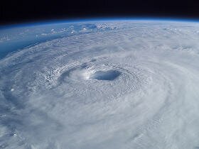
Accuweather’s Warning Regarding Hurricane Earl
|
|
1 September 2010 | posted by: Margery Zimmerman | No Comment

HURRICANE EARL The category 4 Hurricane Earl is plowing towards the US and could briefly hit as a Category 5 early this evening, according to Accuweather. There is very little wind sheer out in the open waters of the Atlantic, so this will let the hurricane get stronger. Starting today, the Dominican Republic, which is on the island of Hispaniola, will be brushed with gusty winds and heavy rain. This time though Haiti will be spared as they have been hit several times in the most recent past. On Wednesday, the hurricane will go just north of the Turks and Caicos Islands. There will be flooding rain, damaging winds, and battering waves. There is a possibility that Earl will deliver tropical storm conditions also to the east side of the Bahamas. So far, Accuweather is saying a direct hit on the US is not expected, but it will start turning and stay east of Florida and ride up the Eastern seaboard all the way to Canada. How much will it be steered or turned is the burning question. Just by moving 50 miles to the west or the east could change the pattern of the hurricane. With Hurricane Earl scraping the coastline by Thursday, there will be very dangerous rip and surf currents from Florida to North and South Carolina. Wave action could reach as high as 15-20 feet on the Outer Banks of North Carolina which would cause coastal flooding and beach erosion. Accuweather is predicting if it holds together, it will make actually landfall in Canada this weekend. Image Credit: |
